Friday, July 6, 2012

Destination Lumbasumba pass

Kanchanjungha is located to east-north Nepal. It is east bordering to India and north to Tibet {China}. To begin this trip - fly to Bhadrapur from Kathmandu about 45 minutes then hire a local possibilities bus/land cruiser for 7 hrs to Phoomling, it drives to north from Bhadrapur. During the driving you take breathing of tea garden of Nepal and attractive scenery surrounding.  Phoomling is the Headquater of Taplejung Dristrict, where lodges & hotels are available.
 
The most people of this area are ethnic group, culturally and religiously people are Buddhist. Theirs daily life is animal husbandry, agriculture including cardamom. You can see wild animals such monkeys, Himalayan Thahr{mountain goats & sheep} & where you can see auspiciously  Red Panda as well as snow leopard on this trekking trail and in spring season blooming Rhododendron and water fall of Arun/Barun rivers. Regarding mountains, horizontally towering views of Mt. kanchanjungha, Mt. Makalu and Kumbhakarna from Lumbasumba pass. Actually, Lumbasumba is the name of snow peak. On this trail your foot will be printed approximately 5177 meter above sea level.
Trekking ends at Num then take a local jeeps/land cruiser  to Khadbari and From Khadbari to Tumlingtar airport also available vehicle.
This route is one of the newest trekking trails which are found in June 2012 by Trekking Agencies Association of Nepal {TAAN}.

Saturday, June 30, 2012

Sex?


Stomach is getting  hunger, nothing to eat at home
Mother, we are waiting  you, with changed hunger  into asleep
Neither we got to eat enough nor wear
Our life is victim of poorness
Thus, we are passing life as well waiting dead...
I am extremely sorry, If it hurts to yours heart...

Saturday, June 16, 2012

Jomsom Muktinath Trekking

Jomsom trek starts from Pokhara. And there are several more route, you may trek across pass Ghorepani or Beni via Tatopani{ Hot spring} or by flight to Jomsom and trek down to Ghorepani via Tatopani. You may diversion Annapurna base camp if you have flexible time frame.
Jomsom is one of the windiest valleys during the day. This trek follows the Kali Gandaki valley between the Mt.Dhaulagiri and Annapurna, which is the deepest gorge of the world on this trek.
Jomsom Muktinath Trek

 You can see the people to whom called Thakali. They are along the Kaligandaki valley in center Nepal. Those are a Tibetan-Burmese people of Nepal. Moreover, most of them are farmer and some are in tourism business. In originally, they are Buddhist as well as moderated to the Hindu.
Muktinath is the most famous pilgrimage centre for the both Buddhists and Hindus. This temple area surrounded by white painted wall where included for both religious temples, as well as around Muktinath villages numerous monasteries. By the way, you can see naturally gas flam and 108 taps with running holy water. You will be walked approximately 120 Kilometer in this trip. Your foot will be printed on 3800masl approximately in the trip which is highest point. Around the  Kagbeni and Muktinath, people are called gurung but they are originally from Tibet at the ancient.

Wednesday, June 6, 2012

Annapurna Base camp trekking

To be trek to the Annapurna Base camp can be tacked as a site-trip from the Jomso or Annapurna circuit. Moreover, especially from Pokhara, all the meeting point is at Chhomrong. The diversion from the Jomsom and Annapurna circuit trek is made from Ghorepani to Ghandruk. On this route, people are ethnic group, Originally Gurung. Which cast is used to go for the Gorkha military services for better financial.


This trek lead to you passes through a variety of landscape from the rice field to the glacier. This trek is ends at a point from where you will to be practically surrounded by elevated white peaks up to 8091masl {Annapurna 1st}. In this trek, you have to walk 100 Kilometers {approximately}.Your footprint will be on 4200masl on this trip.

Thursday, May 31, 2012


Kailash + Guge Kingdom Trekking Via Simikot


The region called as the “Roof of The World”, that strikes relations with the heaven as well in front of the majestic Guge Dynasty relics, you will feel the time backing. Land of ancient traditions and culture. It is land of home {Mt. Kailash} of the Gods and the holiest pilgrimages site for Buddhists, Hindus andas well as people of the Bon religion. Mt. Kailash’s brilliant icy peak is central to the Shamanic traditions that pervade many major religions of the world and whose followers believe this mountain "Gurula mandata", and nearby Nandadevi, is the meeting place of Heaven and Earth. You will visit Lakes Manasarovar and Rakash Tal nested in the lap of Mt. Kailash. Go to Tirthpuri where you will be fascinated by the historical Caves of Padmasambhava, an ancient Buddhist and the source of an abundant natural hot spring. Our tour will take us to Tsaparang the "Kingdom of Guge" and the ancient Tibetan residences. Tibet gives you experience of adventure and opportunity to explore the Himalayas ultimate pleasure of climbing and trekking activities.
Guge Kingdom


It is situated one of the highest elevation with its impressive eyeful viewing. The year-round winter ice and snow that cover and seal this land and the slight broken waves of lakes let down.Tibet is the fine destination to trevelling where surrounded by mountains and lakes. It offers a spiritual journey highlighting one’s lifetime. It is centuries old caravan trails cross the strange landscape through hidden valleys to exotic cities all inhabited by the Tibetan Buddhists. Tibet is a land as mysterious as that millions of pilgrims are hold close it as the world center of holiness.

http://www.nepalhimalayatreks.com/tibet/trekkig-in-tibet/kailash-_-guge-kingdom--trekking-via-simikot.html 

Monday, May 28, 2012

Nepal

Around Kathmandu valley


                          Some Popular Sightseeing Places

1.Kathmandu Durbar Square  
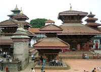
        Kathamandu is the capital of Nepal. Which is located little center eastern Nepal. Kahmandu is improved word as Nepali history. It was known Kastamandap instead ofKathmandu. In Nepali language, Kastha is “wood” and mandap is “stage” {wooden stage}. Where you can see one temple. That is made by singletree. And some more wood used for another temple nearby.
In Kathmandu valley where were three Royal Palaces with different kings at once as Nepali history { Kathmandu, Patan and Bhaktapur}.
The meaning of Darbar is the Palace.
Darbar Square located center of the Kathmandu valley. It is near by old Royal Palace, which called theKathmandu Darbar Square. Where are various temples…

2. Pashupatinath
         Pashupatinath is located eastern part of Kathmandu cities center. This is the most holy and big temple of the Hindu religion. Where pilgrims come to offer to the God “Shiva”from all around the world who follow the Hindu religion. Especially, it is celebrated occasionally of ShivaRatri {the birthday of Shiva}. 
Around the Pashupatinat numerous temples as well holy river beside the Pashupati temple, that called Bagmati. It has believed sentinel spirit and most holy of Shiva shrines for the Hindu. In addition, beside the river, you can see burning the dead body of human. After all burning ceremony that soul could get heaven by easily…

3. Boudhhanath
         Bouddhanath located eastern side of the Kathmandu center city and north of airport.It is the religious center of Buddhist. Where you can see the largest Stupa in the world. This Stupa is white painted and colorful Tibetan prayer flags surrounded.
There are many monastery and Tibetan artifacts and Tibetan refugee. Sightseeing is more interesting by walking both place {Pashupatinath and Bouddhanath} are nearby each other…

4. Swoyambhunath
         Swoyambhunath is one of the Buddhist holy temples in Nepal. It is located western side of Kathmandu valley. It is situated on small hill. This was an Island as a legendary of Nepal. Kathmandu valley was a lake. This lake was drained by a sward against the walls of the valley by the Hindu god Manjushree. Because he wanted to get a closer to look at Adhi-Buddha {Soyambhu}, the beautiful lotus flowers resting on the island. It has one of the biggest images of Buddha and stupas as well. It is also one of the view point of Kathmandu valleys. It is known as a monkey temple, where you may visit monkeys…

5. Patan Darbar Square
      Patan Darbar Square located eastern side of Kathmandu centre city. It is one of the prehistoric palace as well as Kathmandu  and Bhaktapur Darbar Square. The numerous temples are seen Newari {original inhabitant of Kathmandu valley} designed. The lord Krishna temple is multipart of the palace. It is visually seen Shikhara tyle architecture in Nepal. It is only one temple, which is made by fully stone and 21 spires at 17th century…


6. Bhaktapur Darbar Square
         Bhaktapure Darbar Square is located more eastern of Kathmandu city. This is much large, more spacious than Kathmandu and Patan, and much less crowded as well. The main entrance gate is made by gold, whish is most attraction visual. In addition, it has 55 windows. This is why, it is known as 55 windows palace. In this town, you may visit many temples and  pottery .


7. Nagarkot
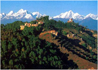
         Nagarkot is situated on hillside {2200mtrs. Approximately}, this is 32 kilometers north-east fromKathmandu. This is one of the best viewpoints to see the mountains. You can see until Dhaulagiri, Annapurna, maslu, Ganesh Himal and Lantang to the west and Gauri Sankar, Everest and Kanchanjunga to the east {the range of the horizon edge west and east}. If weather is perfect, you may see the Mt. Everest as well. By the way, there is a viewpoint {tower} of 360 degree.


8. Namobuddha 
        Namobuddha is a place of Buddhist highly respected by people from all over the world. It is situated slightly higher than Kathmandu. It lies eastern-south approximately 42 kilometers away from the heart city of Kathmandu. The place is clean and quit peaceful as well as feel fresh breathing.
       If you stay for a night and perfect weather in the morning, you can see a beautiful sunrise as well as a wonderful sunset. You can enjoy the viewing with snow-covered long Himalayan ranges that look so amazing. This is the big and rich monasteries comparing to the other places.  

Friday, April 6, 2012


Upper Mustang is a delicate land, which is substitute of Tibet. This part is escapes with many windy passes as well as cultivated arid land. Many villages based on Tibet culture & about 20 Monasteries and picturesque flight between Mt. Annapurna 8091mtrs. & Dulagiri 8067mtrs,


The north of Kagbeni villages generally referred Upper Mustang. The capital of Mustang “Lo-Manthang” was attached into Tibet ,centuries of 14th.
It is identity since through out centuries autonomous kingdom. It is a walled city where about 150 houses, with their own king and people are still mainly Tibetan. This is the reason rather restricted, which required special permit.


The landscape of  Upper Mustang is barren moonscape of  sandstone pillars and discontinuous moraine terraces which together present a colorful mosaic made up principally of an earthen brown, yellow and red. It is easy trekking along the permitted route to Lo Manthang which lies in the very heart of Mustang. The trek to Upper Mustang is through an almost treeless barren landscape and strong wind across the area in the afternoon. Being called “Upper Mustang” is rain shadow of the Himayaya of Nepal. In reality, this kingdom gets rain much less than rest places of Nepal.
Legally allowed to be trek to Upper Mustang is in March 1992. The population of this kingdom was 15869 as year of 2008. They are ethnic group, specially Tibetan-Thakali as well as Buddhist religion. 
By the way, Tiji festival is one of the most important events in Mustang (the ancient kingdom of Lo).  “Tiji” is an ellipsis of the word “Tempa Chirim” which translates as “Prayer for World Peace. It is celibreat for 3 days with Lamas mask dancing and more ativities. This festival is celebreated in May each year. And this year{May 17,18 & 19 2012}


Wednesday, March 28, 2012


Annapurna Round Trekking


Annapurna round is the most famous and one of the best destinations to be explored two weeks to a month. Now days, you may drive up to Jagat  but it is rough road., this is mysterious trek with nature beauty scenery. It starts from Beshishar along the Marsyangdi River with Magnificent view of Mt.Manaslu and Himal chuli to east, this river follows up to Manag-Tilicho Lake { Manang, known as “The country of behind mountain” in Nepal} and it turned west north for the Thorong la. You may do trek to the Tilicho lake as well on this trip as a site-trip. You may visit the people with different ethnic group with multiplicity inhabited. The length of this trip is 300 Kilometer {approximately} your footprint will be printed on 5416masl at Thorong La.
 After the pass, you will be another district, which called Mustang {lower}. It is settlement {phedi} start an hour before than Muktinath.
Muktinath is the most famous pilgrimage centre for the both Buddhists and Hindus. This temple area surrounded by white painted wall where included for both religious temples, as well as around Muktinath villages numerous monasteries. By the way, you can see naturally gas flam and 108 taps with running holy water. Around the  Kagbeni and Muktinath, people are called Gurung but they are originally from Tibet at the ancient.
And then while you reach around Ghorepani via Tatopani{hot spring}, The people are especially ethnic group of Gurung and Magar and some more other. This trek is extraordinary when you visit here in March and April because of the colorful Rhododendron blooming, which is Nepali national flower.
Now, you are heading for Annapurna base camp.This trek lead to you passes through a variety of landscape from the rice field to the glacier. This trek is ends at a point from where you will to be practically surrounded by elevated white peaks up to 8091masl {Annapurna 1st}.


http://www.nepalhimalayatreks.com/nepal/trekking-in-nepal/annapuna-round-trekking.html

Saturday, March 24, 2012

Explore Holiday in Nepal Himalaya


Everest Base Camp trekking is the most famous trekking in the world. If you are fully acclimatized then may trek there. This is the opportunity to see once in lifetime for the most breathtaking scenery conceivable. It gives you massive pleasure to begin an amazing view of the world highest peak. Perhaps, your time will be most quite feeling which will be never come again.
We will fly to Lukla about 30 minutes from Kathman then after start the trek same day to Phakding or Mano as first night. At Namche Bazaar, will be spend 2 nights. Where you may go to Everest view hotel as well as Khumbu sherpas villages around. It is for the acclimatization and panoramic view. You will pass one of the highest airport of the world while you hike to Everest view hotel, it is called Syangboche airstrip and situated on 3841 mtrs.

Normally, trekkers follow Everest base camp via route of Tyangboche Where the world famous Tyangboche monastery {3860mtrs.} has been located is one of the most attractive places of Everest region for natural and religious sightseeing. 

The valley of Dingboche or Pheriche whether you stay, just keep in mind to have a next day for acclimatization around… and will be better idea if you plan to sleep one night at Thukla before go to sleep at Labuche. Anyhow, you have to stop for a night at Labuche. If you are planning go to both point {EBC and Kalapthar} you have to sleep at Gorakshep for a night. But just for climb to kala pathar you can make up Labuche – Kalapathar – Labuche, if you start early morning… You are already feeling proud and quite at this height because you are just close to the world highest peak.
From the Everest base camp, you will not see the Mt. Everest…

Chola pass – EBC, Cho La, Gokyo as well Renjo La trekking routes have good lodges and teahouse facilities management by both Sagarmatha National park management and local ethnic group. The lodges provide to the trekkers good and delicious food.
This route demands previous experience of walking on snow/ice over the pass, it takes you into the heart of the mountains and the foot of the earth highest point as well as more peaks.
In addition - certainly, one of the longest glaciers of the world {Khumbu glacier} and the biggest glacier of the world {Ngozumpa glacier}.

Day 01. Arrival Kathmandu  1335 Mtrs. AM/PM. And then drove to hotel
Day 02.  Details information and  basic preparation about  the trip
Day 03. Kathmandu to Phakding 2610 Mtrs. { {fly to Lukla 2842 Mtrs. and then trek…}
Day 04. Phakding to Namche Bazaar {3440 Mtrs.}                     
Day 05. Namche Rest day {Acclimatization day, site trip}
Day 06.  Namche to Tyanboche {3860 Mtrs.}
Day 07. Tyangboche to Dingboche {4360 Mtrs.}
Day 08. Dingboche rest day {Acclimatization, site trip}
Day 09. Dingboche to Labuche {4910 Mtrs.}
Day10. Labuche to Gorakshep 5140 Mtrs.- Everst base Camp 5360 Mtrs.-back to Gorakshep for night
Day11. Gorakshep to Dzongla 4830mtrs. {early morning climb to Kalapathar 5550 Mtrs. then…}
Day12. Dzongla to Thangna 4700Mtrs. {Chola pass 5368mtrs.}
Day13. Thangna to Gokyo {4750 Mtrs.}
Day14. Gokyo –Ri 5360 Mtrs.{Hiking} and if you have time you can visit to 4th and 5th lake 4843/4990 Mtrs.
Day15. Gokyo to Dole 4084 Mtrs./Phortse-thanga 3680Mtrs.
Day16. Dole/Phortse-thanga to Namche or Khumjung {3753 Mtrs.}
Day17. Namche/Khumjung to Lukla
Day18. Lukla to Kathmandu
Day19. Back to Home country {or you can do sightseeing… as yours timetable}


http://www.nepalhimalayatreks.com/nepal/trekking-in-nepal/chola-pass-trekking.html

Trekking in Nepal


Gokyo Trekking in Nepal


Gokyo Trail follows the EBC route as far as Sanasa and then follows middle of left trail usually you may see the map at the junction. This trail follows the Dudh Koshi source. If the lakes are not frozen you will see green lakes along the moraine of the Ngozumpa glacier. Gokyo valley is more satisfying destination then EBC because beside the largest of the Gokyo lakes in a basin of snow peaks surroundings. And the sense of communing with nature is extra profound then Everest Base Camp Trek.
From the Gokyo Ri mountains are more spectacular and the Ngozumpa glacier is the largest in the Nepal himalaya and you will see far back side/east brown the 5th highest Mt. Makalu 8463mtrs,about one hour climbing, highest peak of the world Mt. Everest 8848mtrs, 4th highest peak Lhotse 8501mtrs, 6th Lhotse-Shara 8383mtrs, to the north 9th highest Mt. Cho Oyu 8153mtrs which you could see before entered Gokyo valley. Thus, you can enjoy with many more others highest peaks, which are surrounding you and Renjo La as well.  If you have flexible timetable its offer hike to fifth lake of Gokyo valley {from where chance to see the Mt. Everest so far
.http://www.nepalhimalayatreks.com/nepal/trekking-in-nepal/gokyo-trekking.html

Day 01. Arrival Kathmandu 1335 Mtrs.AM/PM. And then drove to hotel
Day 02. Details information and basic preparation about the trip
Day 03. Kathmandu to Phakding 2610 Mtrs.{fly to Lukla  2842 Mtrs.and then trek…}
Day 04. Phakding to Namche Bazaar 3440 Mtrs.       
Day 05. Namche Rest day {Acclimatization day, site trip}
Day 06. Namche to Phortse-thanga 3680 Mtrs./Dole 4084 Mtrs.
Day 07. Phortse-thanga/Dole to Machhermo {4410 Mtrs.}
Day 08. Machhermo to Gokyo {4750 Mtrs.}
Day 09. Gokyo-Ri {Site trip} and if you have time you can visit to 4th and 5th lake next day
Day 10. Gokyo to Phortse {3810 Mtrs.}
Day 11. Phortse to Tyangboche 3860 Mtrs. {you may visit to Pangboche 3930 Mtrs. monastery either same day or
            next morning}
Day 12. Tyangboche to Khumjung 3753 Mtrs./Namche/jor-salle
Day 13. Khumjung/Namche/jor-salle to Lukla
Day 14. Lukla to Kathmandu
Day 15. Back to Home country {or you can do sightseeing… as yours timetable}